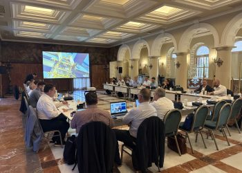
The Santa Cruz de Tenerife Port Authority has presented its flagship proposal for the 2026 edition of the Ocean Hackathon in mid-October: the development of a prototype intelligent map conceived as a Google Maps for the decarbonization of maritime transport. The initiative, coordinated under the framework of the Tenerife Science and Technology Park and INtech Tenerife, seeks to create an interactive digital platform capable of integrating territorial intelligence, navigation data and energy variables to accelerate the ecological transition of Atlantic routes.
The challenge, led by Santiago Yanes from the Tenerife port authority, will take place intensively from October 16 to 18 at Enclave Cuevas Blancas. The call is aimed at a multidisciplinary profile encompassing software developers, data analysts, naval and chemical engineers, oceanographers and logistics specialists, with the support of organizations including the Canary Islands Ocean Platform (PLOCAN) and CIDIHUB, among others.
Integrating AIS data, energy capacity and a conversational AI assistant
The platform’s technical objective is to unify complex sources of information that have historically been dispersed in an interactive geographic information system (GIS). The system will cross-reference maritime traffic data from the Automatic Identification System (AIS) with the energy infrastructure available in port basins, the proximity of renewable energy production plants, supply points for alternative fuels — such as hydrogen, ammonia and methanol — and the battery storage capacity of vessels in transit.
The proposed solution is intended to operate as a digital twin of the port and navigation environment. As a differentiating feature, the prototype must integrate a conversational assistant based on generative artificial intelligence. This interface will allow shipping companies, logistics operators, investors and public administrations to make natural-language queries to assess the ports’ level of readiness in real time, calculate the technical feasibility of new sustainable corridors and prioritize investments in clean-supply infrastructure.
Technical competition and push for data sovereignty in the Atlantic
Tenerife Ports’ proposal is part of the race to position the Canary Islands’ ports as decarbonized fuel-supply hubs on routes between Europe, Africa and the Americas. The development of territorial intelligence tools responds to the requirements of European regulations on reducing emissions from maritime transport and the gradual introduction of alternative-fuel quotas. During the 48 hours of continuous work at INtech Tenerife, development efforts will focus on establishing functional API connections with public and private databases. The resulting tool aims to transform abstract decarbonization metrics into an operational dashboard that facilitates strategic decision-making in the Atlantic logistics sector.
The article Tenerife Ports unveils idea at Ocean Hackathon: a green maritime Google Maps was first published on canarymaritime.com.